Our drone surveys

T&A Survey Drone Services uses unmanned aircraft systems (UAS) or drones to acquire, process and interpret geophysical, geological and environmental data sets. By combining our knowledge and experience in gathering data by using a large variety of geophysical techniques with the latest UAS technology, we offer a broad range of unmanned services to our customers.


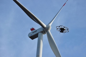
Our drones can be used for the inspection of plants, structures and objects which are otherwise hard or impossible to reach, for example wind farms (onshore and offshore), high buildings, bridges, chimneys, high-voltage pylons and cables.

Advantages of drone monitoring and inspection

  • The aerial photographs have a higher resolution because they are taken at closer range.
  • Inspection with drones is up to four times cheaper than traditional aerial photography.
  • Performing inspections with drones is considerably safer than manned inspections.
  • Heat leaks which can damage the insulation of electricity coils can be detected.
  • During inspection there is no need to shut down the plant.
  • Drones can also fly under the cloud cover.

Measurement techniques


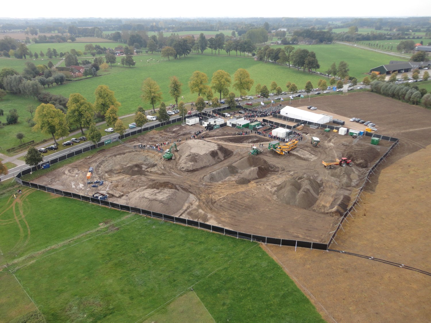
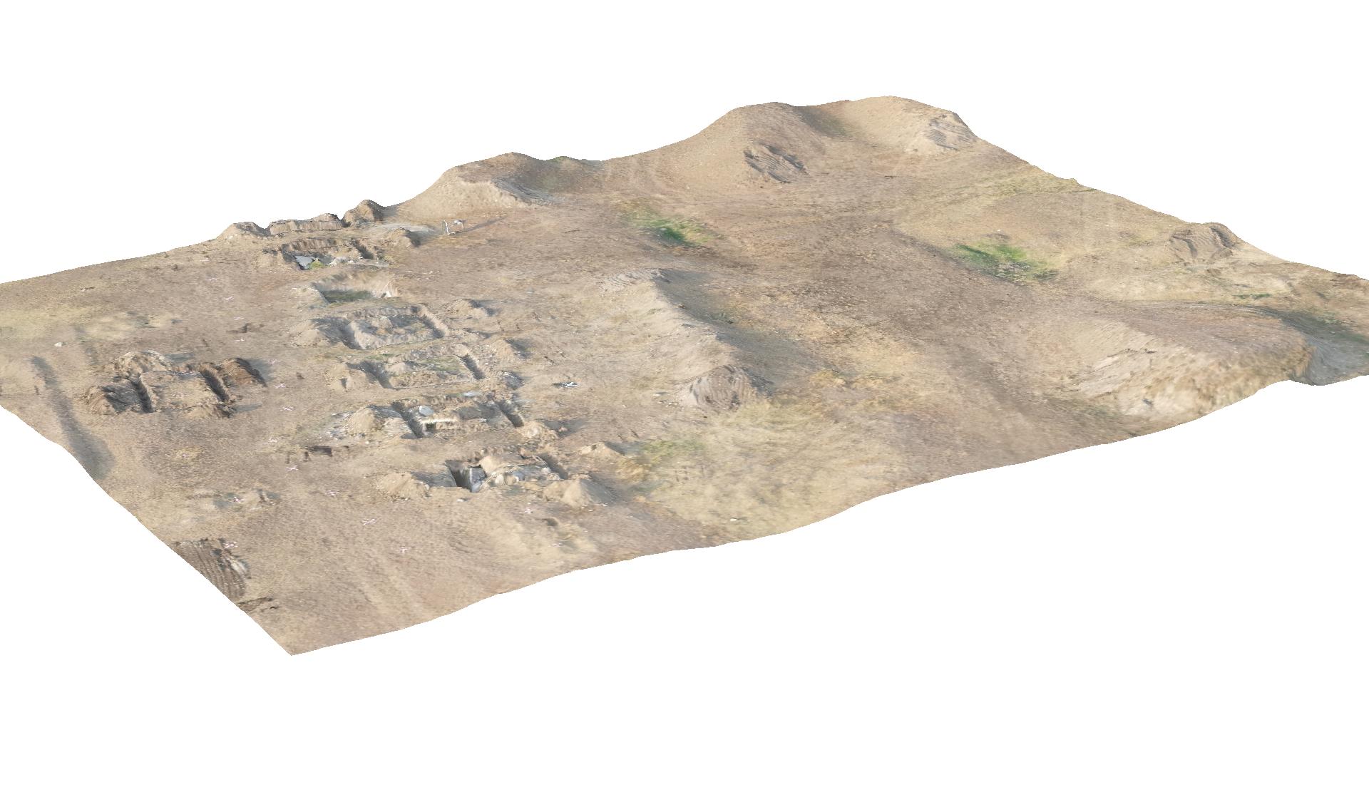
The use of drones can provide new perspectives during archaeological research and excavations. Especially in surveys covering large areas with many underground artefacts, such as ancient foundations, the use of drones can reduce time and costs and improve the quality of the project considerably. This way the excavation activities can be more focussed.

Besides 3D mapping of archaeological excavations, drones can also be implemented to make maps of micro-relief in the landscape and for visualizing archaelogical remains.

Advantages of archaeological drone research

  • From the air it is possible to see structures and patterns that are not visible from the ground, because the overview is missing. 
  • Quick insight in the presence of underground artefacts making excavations more focussed reducing costs and time.
  • The costs of using a drone are much lower than for manned flights.

Measurement techniques

* In test phase

Deformations and weak spots in dikes can be detected quickly and efficiently with geophysical research. This can be done from ground level but also with a drone.

Drone IR Thermography

T&A Survey Drone Services conducts dike inspections using a drone equipped with an Infrared (IR) thermography camera. The IR thermography camera provides a thermogram, a visual representation of the temperatures on the object of measurement. Weak spots in dikes are often not visible to the eye, but can easily be recognized on thermography images. It is therefore important to have the GPS coordinates of each recording, in order to accurately locate weak spots.

Drone LiDAR

With a LiDAR (Laser Imaging Detection And Ranging) sensor attached to a drone, T&A Survey Drone Services can register the geometry of dike bodies in detail. The LiDAR sensor measures the distance to a point in the surroundings using a laser pulse. This results in a point cloud of millions of points. The end result is a very accurate 3D image of the surface of the dike.

Drone photogrammetry

Photogrammetry is the making of maps with a special, high-resolution photo camera. By attaching this lightweight camera to a drone, high-resolution digital 3D aerial photographs are generated which are then processed with special software.

 
Combining measurement techniques for drone and waterbottom research, T&A  can make 3D digital elevation and terrain models and orthophoto mosaics of areas streching both above and below the water level.

Combining drone and waterbottom research

The parts of the research area which are situated above the water level can be mapped by drones. The area below the water level will be surveyed from a vessel equipped with multi probe gradiometer, side can sonar, echosounder and/or multibeam. Waterbottom research can also be performed using a ROV (Remotely Operated underwater Vehicle) and/or an AUV (Autonomous Underwater Vehicle).

By combining the results of the surveys, we are able to create a complete digital terrain model of for example breakwaters, piers, floodplains, delta's, harbours and coastal area's.

Advantages of combined surveys

  • All images made above and below the waterlevel are integrated into one othophoto mosaic.
  • Projects can be carried out in a shorter period of time compared to traditional survey methods.

Measurement techniques


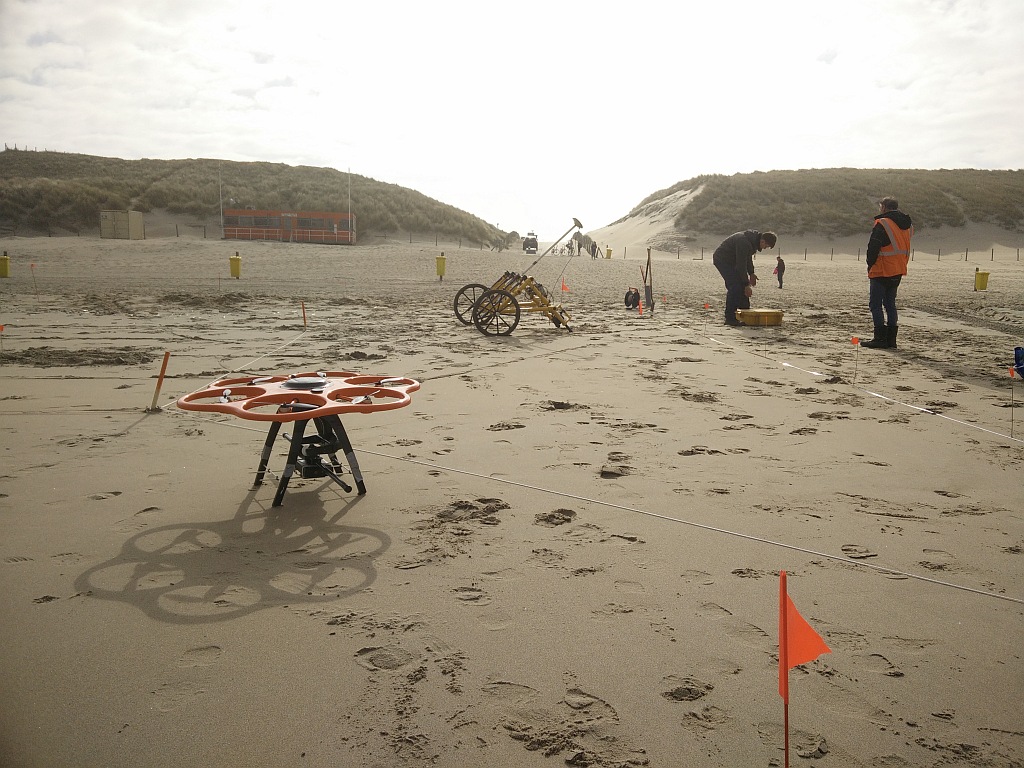
Unmanned Aerial Systems (UAS) or drones are very suitable for the detection of  UXO in large or inaccessible areas. Drone UXO detection is done with a drone magnetometer system*.  During the flight the drone is kept at a constant hight using a laser sensor, in order to obtain accurate results with high resolution. All flight details (speed, hight, location) are registerd and are completely reproducible in order to ensure the quality of the survey.

Advantages of drone UXO surveys

  • Inaccessible areas or heavily polluted sites become accessible for surveying.
  • Higher productivity, especially in open areas.
  • Obstacles are not a problem as the drone can avoid them.
  • High resolution data.
  • Less personnel and equipment is needed, making the survey more cost-efficient.

Measurement techniques

* Currently in test phase

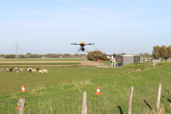
Drones provide an important innovation in vegetation monitoring in agriculture and flora and fauna research such as counting certain animal species in nature reserves..

Drone crop monitoring

By attaching a multispectral of hyperspectral NIR (near infrared) camera to a drone it is possible to map the weak spots or diseases such as mould in the vegetation, and monitor them over a period of time. Soil quality, composition and humidity can be mapped from a drone as well.

Farmers make more and more use of drone technologies to monitor the health of their crops, allowing the use of pesticides to be more targeted and less frequent. This way, both costs and and pollution of the environment (soil and groundwater) can be reduced.

Advantages

  • Unlike satelite images, drones are able to make detailed maps of relatively smaller areas.
  • Much lower costs compared to manned flights.
  • Less environmental pollution due to more targeted use of pesticides.

Measurement Techniques


With the help of T&A Drone Services' drones, the environment can be monitored for erosion, land degradation and the encroachment of invasive species. Pollution and environmental disasters can be monitored and the appropriate restorative action plans can be identified and carried out.

Advantages of environmental drone inspections

  • UAVs offer a timely and cost effective means of collecting high resolution data for environmental survey and monitoring purposes.
  • Inspection of areas which are otherwise difficult or dangerous to access.
  • Drones can cover a vaster area compared to conventional survey methods.
  • The high-res images transmitted by the drone can be viewed in real-time or immediately after flight. If necessary, more detailed on the spot inspections can be carried out. 
  • Since the flight plans are based on GPS positions, they can be repeated on a regular basis for purposes of comparison, analysis and planning. 

Measurement Techniques

* In test phase
Project: Vihovici coal mine contamination mapping
Project: Rosia Montana goldmine contamination mapping