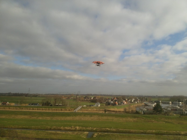
T&A Drone Services uses lightweight and easy-to-transport drones and measuring techniques, making aerial surveys accessible to a wider audience. We bring all equipment to the research area, take off on the spot to carry out the survey. This means that we can deliver custom work wherever our clients wish.
Why T&A Survey Drone Services?
More than 25 years of experience in geophysical suveys and remote sensing, providing us with extensive knowledge of data acquisition, processing and interpretation.
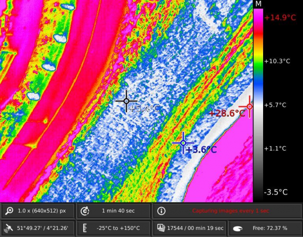
The use of drones for specialised subsurface and surface research.
Combined with a wide array of sensors and geophysical technologies T&A Drone Services' fleet of drones provides the optimum configuration for your specific goals.
T&A Drone Services employs geophysicists, UXO-specialists, archaeologists, environmental scientists, remote sensing specialists and geologists, making communication easy and efficient.
The flights are performed by a certified drone pilot together with one or several of our technical specialists.
T&A Drone Services is certified to perform commercial drone flights and all of our drones are officially approved.
Advantages of using a drone
The use of drones in airborne surveys has many advanges compared to conventional research from groud level or airborne surveys using manned helicopters or airplanes.
T&A Survey Drone Services uses unmanned aircraft systems (UAS) or drones to acquire, process and interpret geophysical, geological and environmental data sets. By combining our knowledge and experience in gathering data by using a large variety of geophysical techniques with the latest UAS technology, we offer a broad range of unmanned services to our customers.
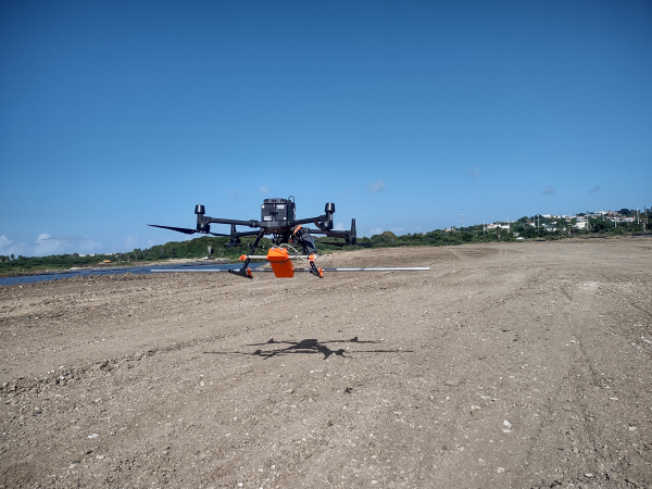
T&A has a wide range of sensors and geophysical techniques in house that can be attached to our drones in order to perform a survey. This way we can offer our clients the best configuration for every project.
T&A is in the possession of multirotor (SuperFox and Aibot), fixed wing and helicopter drones. Each type of drone is suitable for specific types of surveys. Based on our knowledge and experience, we determine which drone-sensor configuration will lead to the best results for each project. Our drones are all approved and our drone pilots are fully certified.